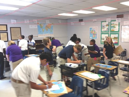
Students learn about map skills
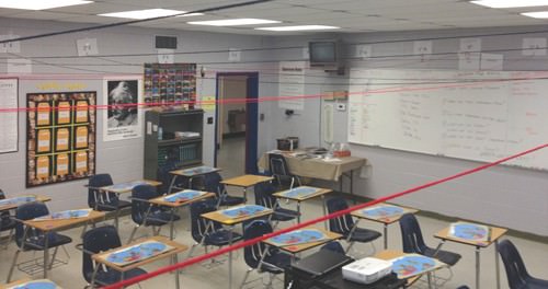
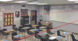
Joey Parker’s social studies students at Haywood Middle School recently studied a section on map skills, latitude and longitude. “Knowing that my students are visual and kinesthetic learners, I thought the best way to make the material more interesting was to find a way to bring it into the classroom in a way that was very interactive,” Mr. Parker said. “In thinking on this, I came up with the idea to hang signs throughout my room for the Equator, Prime Meridian, and various points along these lines. Once this was done, my entire family chipped in one night with helping me run strings across my room in a grid pattern to make the concept of latitude and longitude easier to apply.”
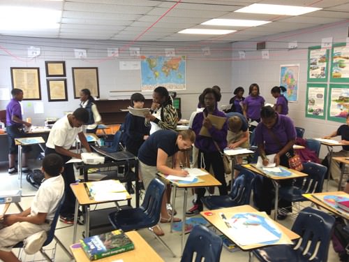
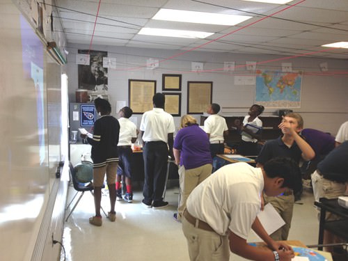
Mr. Parker said his students entered class the next day and were extremely curious about what this was all about, but he let anticipation for the lesson build for a couple of days to peak their interest. When the day of the lesson finally arrived, he had the students use a classroom map that they had already worked on in previous lessons to plot the locations of items throughout our classroom.
“It was a fun lesson for them as it allowed them to move freely about the room while speaking and working with their neighbors as well as receiving immediate feedback on their work,” Mr. Parker said. “Once everyone was finished, I called on students to come up to the board and guide the class in how they located the items. I closed the lesson by referring the students to their individual world maps to highlight how this small demonstration within our classroom could be applied to any map they used or even as a tool in using a GPS.”
Overall, Mr. Parker said he was extremely pleased with all of his students’ performance during this lesson. “Despite individual challenges, each one of them was eager to participate and demonstrated higher order thinking in applying and explaining their reasoning to the class.”
Related Posts
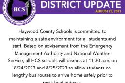
District Update – Early Release (8/24 and 8/25)
Attention HCS Families - All HCS schools will dismiss at 11:30 a.m. on…

ESSER 3.0 Stakeholder Survey
Haywood County Schools is requesting stakeholder feedback on how the district…
HCS 2023-24 School Supply Lists
School Supply lists for the 2023-24 School Year are now available. Please note…